Flying the backcountry of Utah
(aka The Avoidance of Paved Runways)
Late April 2007
I instruct backcountry flying for McCall Mountain Canyon Flying Seminars, and the company has recently expanded from the back country of Idaho and the Frank Church River of No Return Wilderness into the canyon country of Utah. Spring is one of the two best seasons for flying the Utah canyon country because it is too hot in summer and too snowy in winter. This year's spring Utah seminar ran from 25-29 April. This collection of pictures and commentary includes a week of vacationing followed by the seminar happenings.
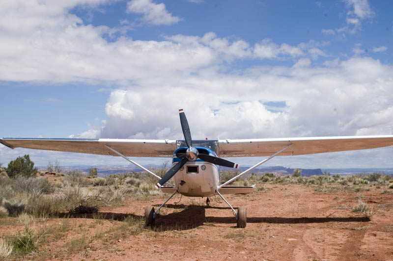
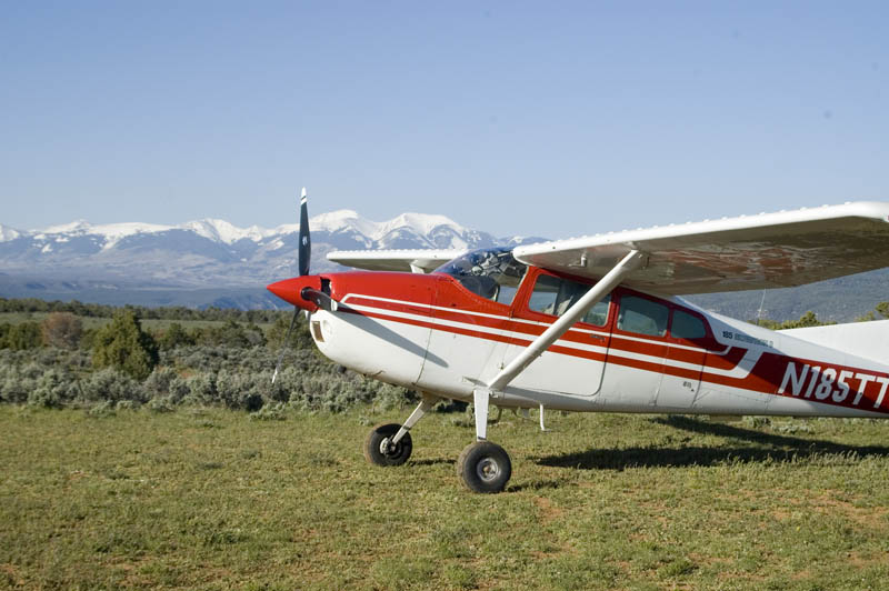
The trip to Bluff UT (homebase for the seminar) started from Poplar Grove IL on Sunday 15 April. Karen and I piled our camping gear into the trusty old 1973 Cessna 180, with stops in the Denver and Salt Lake City areas.
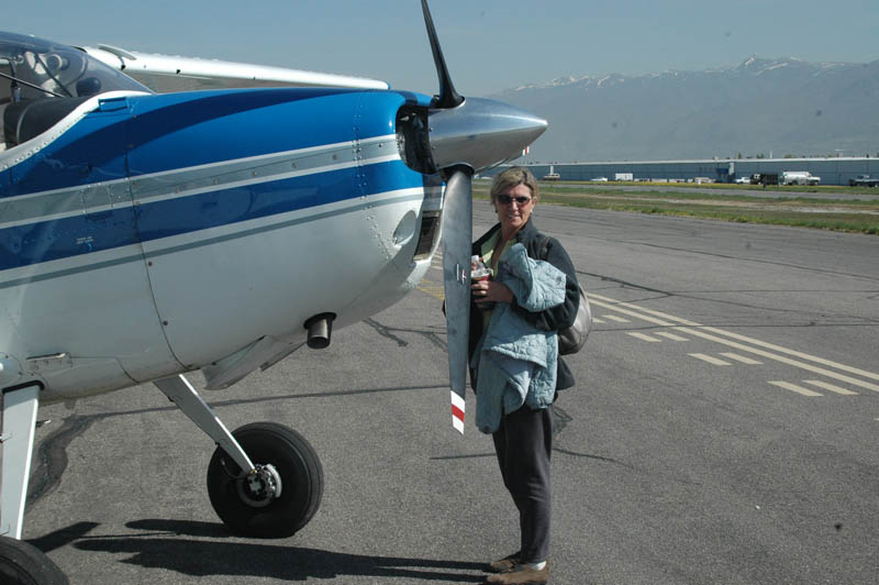
First officer Karen Lison at Skypark, Bountiful UT
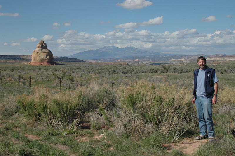
Captain Lytle Johnson, somewhere along the road from Cortez CO to Moab UT
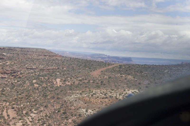
We climbed out of Salt Lake City area and headed for the canyon country.
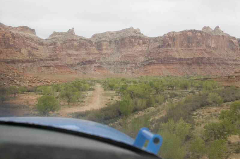
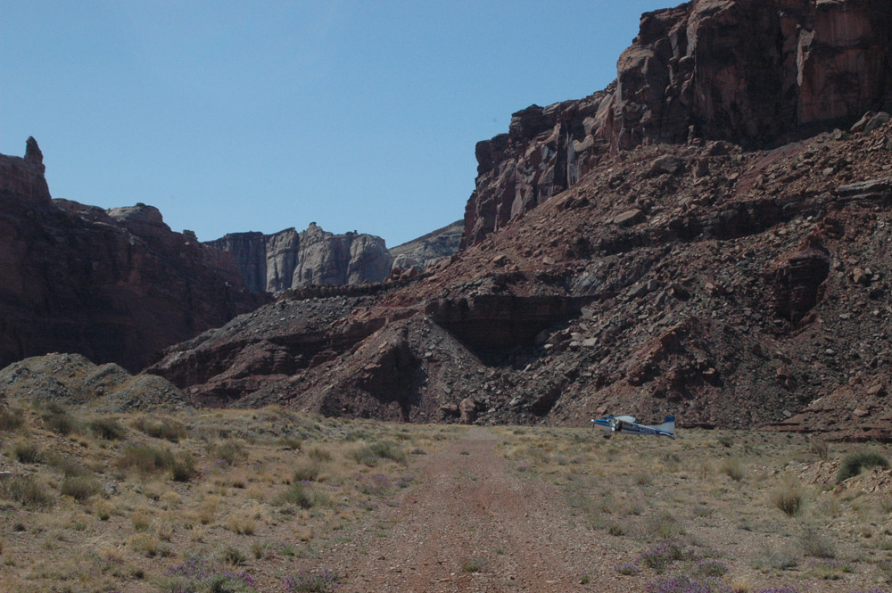
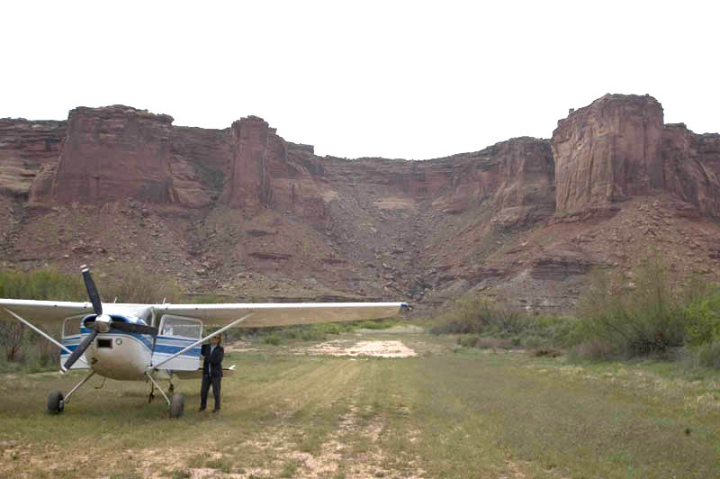
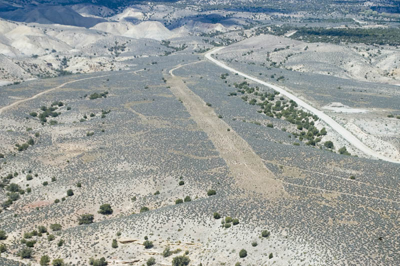
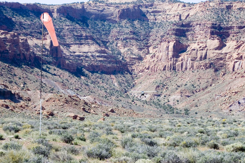
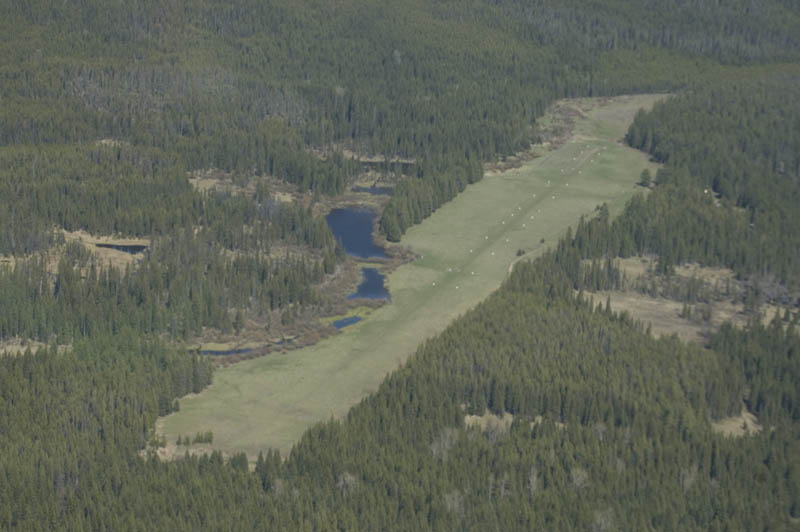
This is short final to Mexican Mountain, length 1325', elevation 4660'. We spent two nights airplane camping here.
Mexican Mountain just before touchdown.
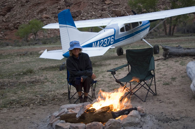
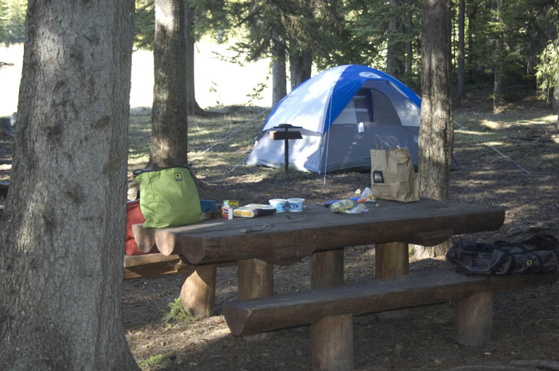
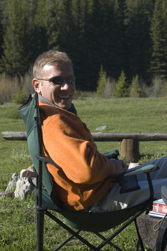
Karen relaxing at campfire, Mexican Mountain. It got COLD at night!
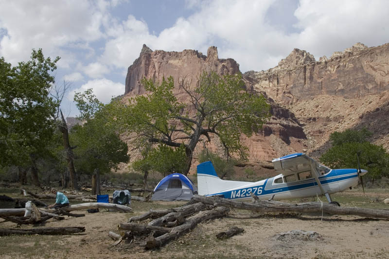
Home away from home. Being from Chicago, Karen appreciates the remoteness of these airstrip campsites.
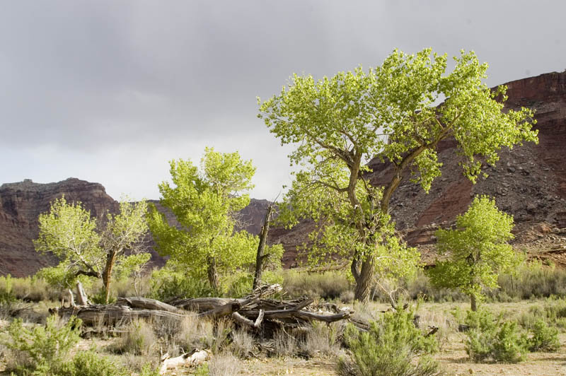
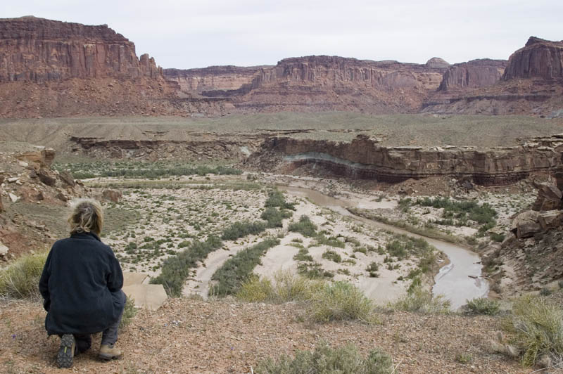
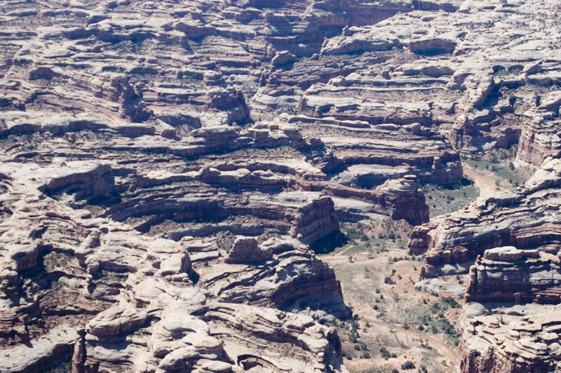
Constantly changing sun and clouds make for great photography.
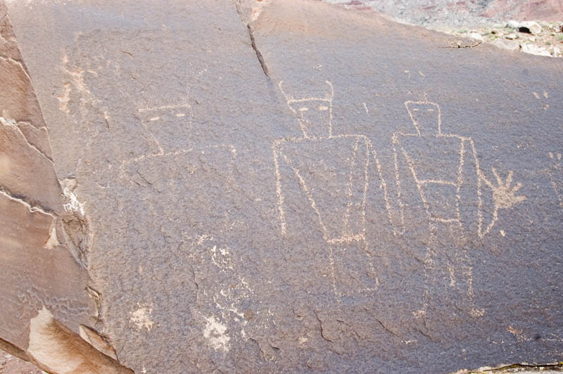
Anasazi petroglyphs near the runway, from perhaps 1300-1400 AD.
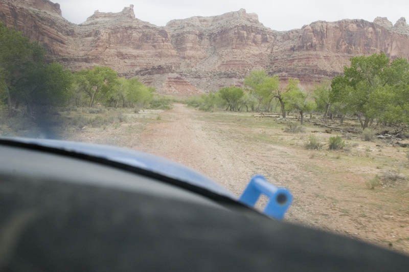
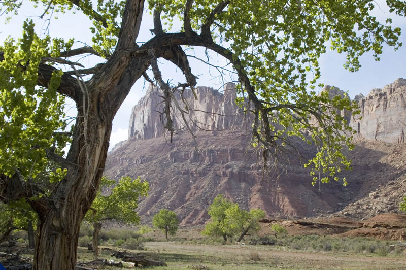
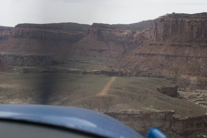
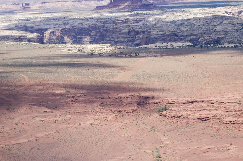
Scenery along the route after leaving Mexican Mountain.
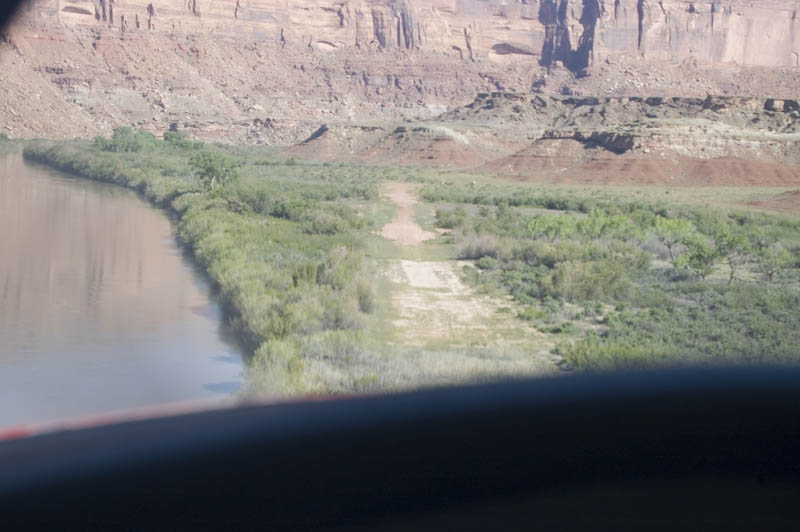
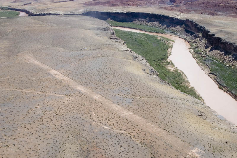
Short final into the Mineral Canyon airstrip, on the Green River near a popular rafter access point. This area is a beautiful little oasis. Runway was fairly soft, except for the green patch about 1/3 of the way down. The tiedown area to the right of the runway also seemed firm. Length is 2200', at an elevation of 3946'.
We stopped on the firmest part of the runway.
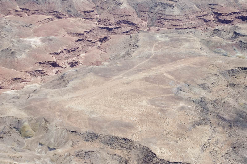
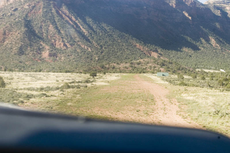
After Mineral Canyon we went to Dirty Devil, length 1200', elevation 4153'. Steep drop-offs on each end of the runway can make for some interesting approaches if it's hot and/or windy. It is best to fly in the cool morning hours in the mountains and canyons.
Karen surveying the scenery from the north end of the runway.
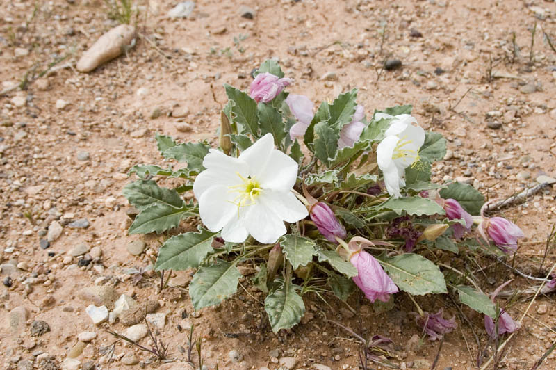
The little white flowers that were everywhere at Dirty Devil.
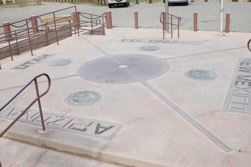
Karen's flight back to Chicago left from Cortez CO, so we became tourists for a day. This picture is of Four Corners monument in Navajo country. Yes, we had to run around the center in a circle so we could visit all four states in 4 seconds.
So, now I was on my own. The weather turned horrible (big wind, big rain), so I hunkered down in Bluff UT and did laundry at the local laundromat. I was the only paleface in there, but learned a few words of Navajo. Ya'teh!
Still one more day till class participants showed up. Boss lady gave me a list of strips to check out, and the sun was shining, even though the wind was blowing pretty good. So off I went.
My first stop was Zahn's Camp (also known as Zahn Bay?), along a tributary of Lake Powell. Length 1000', elevation 3750'. I couldn't find a wind indicator and guessed wrong, bouncing and screeching to a halt at the uphill end (at least I figured out which way was UPHILL before I landed!).
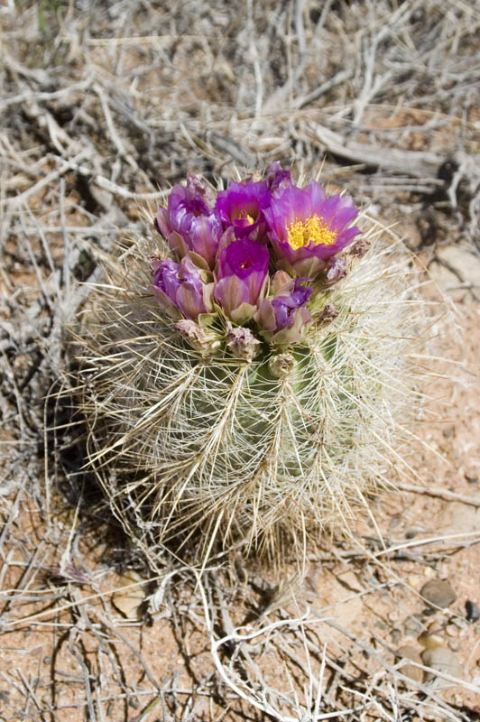
The barrel cactus was just beginning to bloom at Zahn's Camp, making up for the exciting landing.
Considerably higher than Zahn's Camp, but only a couple miles away, is Nokai Dome, a beautiful strip running uphill to the east (direction shown), with a drop-off making you feel like you're on top of the world. Length 2150', elevation 5696'.
The strip at Nokai Dome is red dirt and a little soft, but cell phones work up there!
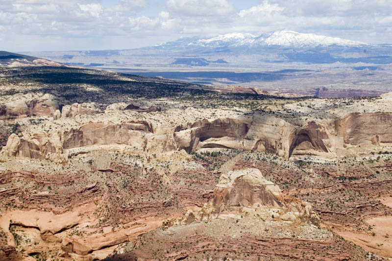
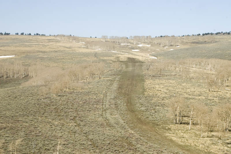
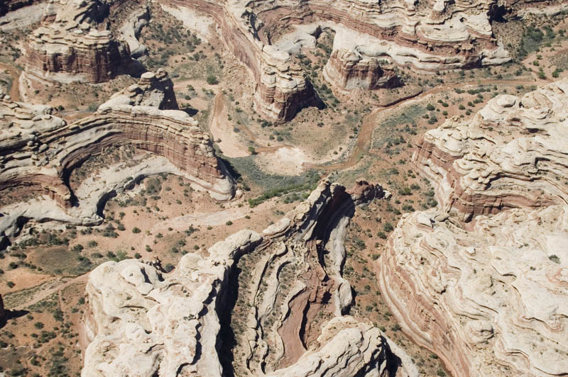
I headed north from Nokai Dome toward Big Thompson Mesa, finding amazing scenery enroute.

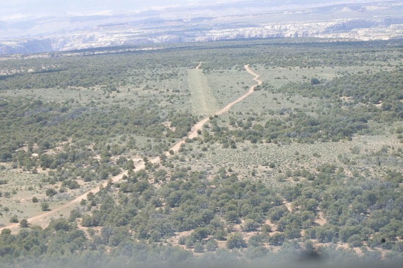
The Big Thompson Mesa airstrip, on a high final. Dirt tire tracks were rutted, so I landed in the trace of a runway beyond them. That's Capitol Reef National Park to the left, across a spectacular valley. Length 1550', elevation 5010'.
Looking back down the "runway" before taking off. Until I get to know a strip, I like to turn at the end of my landing roll and take off in the opposite direction, because I've already been on that section of dirt. I'd rather pay the price of a few knots on the tail and know what I'm dealing with.
This strip is called Star Spring (or maybe Ticaboo per UBCP) and is ROUGH, with a couple good sized trees along the goat track runway. Elevation 5400', length not reported. We decided this strip was needlessly rough and if we every had to go in here again, the dirt road next to it would be a better choice. UBCP website seems to agree and calls it unusable.
Piute Canyon airstrip (length 1500', elevation 5509'), where I decided to exercise command authority and not land. Wind was a straight crosswind, gusty, and I noticed a GPS groundspeed difference of 40kts between into the wind and with it. Maybe we DO learn from experience....
but then again maybe we don't. This strip is called Dark Canyon on the chart, but locals call it Lean-to Pt. Length 2500', elevation 6702'. It was covered in sagebrush, had roller coaster dippy-dos, and the wind was blowing fairly strong straight across it. Oh well, another one for the "there I was, wish I wasn't" category. Time to head for the barn and await the first official day of the seminar.
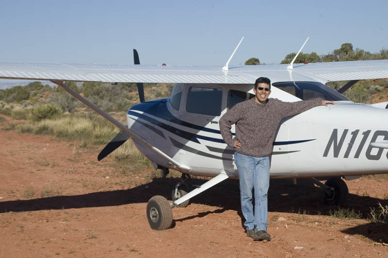
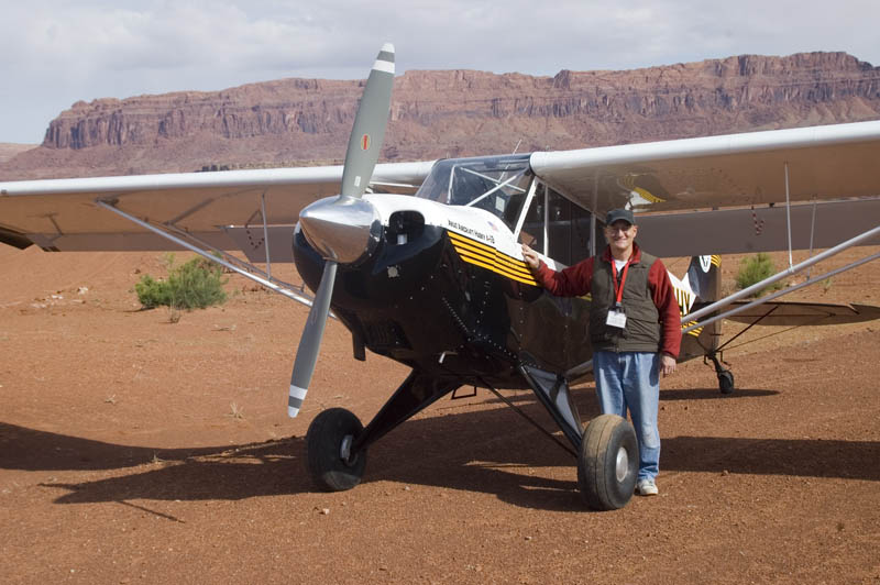
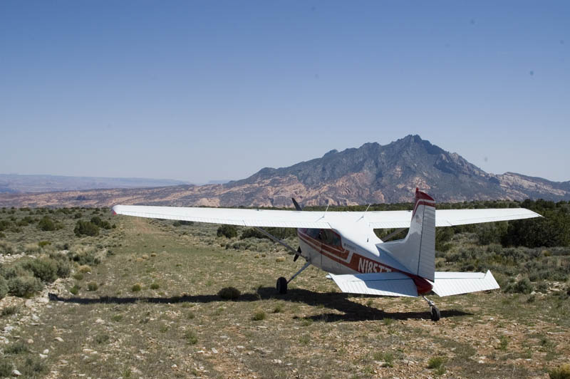
25 April 2007, opening day of the Utah Canyonlands Safari. This is my first seminar participant, Steve. He has a nice 2005 Turbo 182, one of two nose-wheeled airplanes in the seminar. Here we are at Nokai Dome, making our turns on the ground wide, without locking the inside wheel and holding back pressure to keep weight off that nosegear.
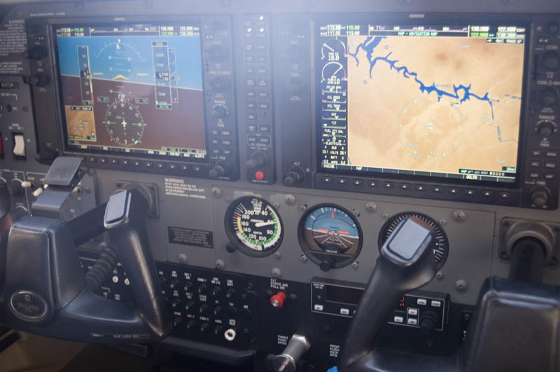
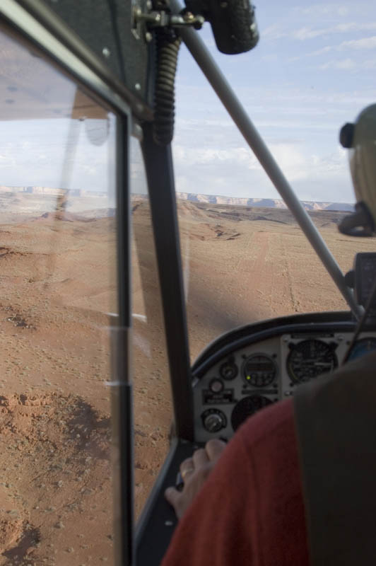
A nice G1000 panel. Note the relatively low airspeed, a very important parameter in effective backcountry flying.
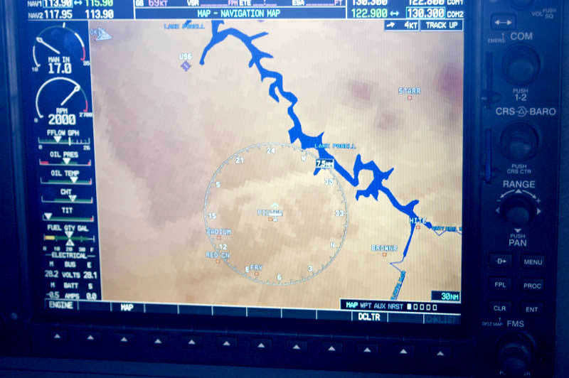
The GPS moving map shows an area where we typically work, east and south of Lake Powell. U96, near the top, is Cal Black, a nice hard-surfaced runway with fuel. Fuel is also available at Moab, Green River, Blanding, and Price, although Price is a bit far. The little white arrow in upper left shows North.
"Gosh, Yogi, what are we going to do NOW?"
"I dunno BooBoo, but we'll think of SOMETHING!"
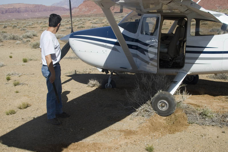
Note Steve with part of his tiedown kit, staring at the top half of a nosewheel, and the left main tire track suggesting maybe a locked wheel during the turn. The sagebrush was a contributing factor.
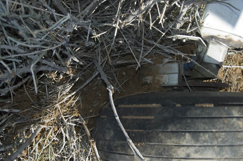
One very good reason why we insist that seminar participants remove wheel pants before flying with us in the backcountry. Just like Forrest Gump says, "It happens".
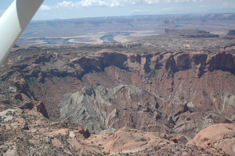
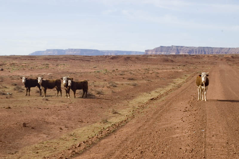
The Brown's Rim airstrip, with Cataract Canyon of the Colorado River on the north side, flowing into Lake Powell. Length 2100', elevation 4883'.
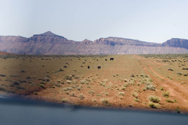
A rather low pass at Brown's Rim, trying to encourage the local inhabitants to graze somewhere besides the runway. We quickly learned that it does no good to buzz the runway and scatter cows to both sides; they are herd animals and immediately try to get back together. Better to fly to one side and encourage them to all run in the same direction.
The next day started with nice low angle sun on Monument Valley making for long shadows and an interesting picture. Although not shown here, hot air balloons were aloft in the calm air.
Tom with his Husky at the north end of Piute Farms airstrip that is also a road. The south end of the airstrip is on reservation land, and not all the locals welcome visitors. This can lead to opportunities for making new acquaintances and brushing up on negotiating skills.
Ownership of the runway seems to be in dispute.
An instructor's view from the back seat of a Husky. This patch of red dirt is the Mexican Hat airstrip, length 2050', elevation 4313'. Again, note the low approach airspeed.
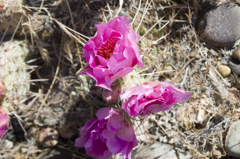
It was a much calmer day than my previous visit to the Piute Canyon airstrip, so we landed and found these lovely flowering prickly pears.
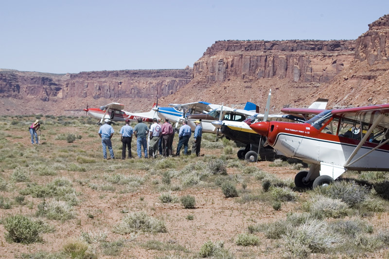
The whole group of seminar participants and instructors got together at Happy Canyon for lunch and a group picture. Length 1380', elevation 4934'. A rather decrepit shack remains from the uranium exploration era. Happy Canyon was a central headquarters, with inside bunks for at least eight workers in two separate rooms. There is even a $50 certificate in a glass case on the wall, issued by Madam Somebody at a thriving business in Nevada. Break glass in case of emergency!
Husky on approach to the overgrown short runway at Happy Canyon.
Awesome view including a 185 and a good runway at the Gold Creek airstrip (aka Shootering), length 3000', elevation 6095'. We discovered we had cellphone coverage here too! There is a beautiful meadow and a dilapidated homestead at the bottom of the strip, with a babbling stream running through it (at least at this time of year).
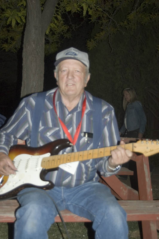
It wasn't all work and no play. Lavar Wells of Red Tail Aviation in Moab was one of the instructors for this seminar and he brought an immense amount of local knowledge to the course for all of us. He has been flying this country for many years and is chief pilot for Red Tail. What looks to be just another beautiful rock formation to us has a local name and a history for Lavar. He showed us airstrips that most people don't even know about anymore because they fell from use decades ago, but sure enough, the traces can still be seen. And although we know only that many of the strips were the result of the uranium boom in the 1950's, Lavar knows details of the management, quality of the deposits, where the access roads ran, and on and on.
We were also pleasantly surprised by his abilities on the guitar to accompany his singing, as well as his stories of local history. Do you really think Butch Cassidy died in South America? The canyonlands were Butch Cassidy's backyard and he had a lot of friends and relatives. There are strong suggestions that the popular movie might not be historically accurate.
If you want to fly with one of the best, contact Lavar.
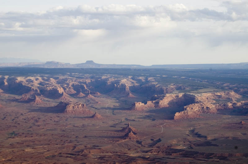
Toward the end of the seminar we expanded our area of interest to include western Colorado. This beautiful strip sits on a mesa above Gateway CO and the Dolores River. It is called Dolores Point and is 3300' long at an elevation of 7154'. I'm looking forward to camping here someday.
The view from Dolores Point is absolutely stunning.
There is a hotel in Gateway that maintains this airstrip called Hubbard on the Denver sectional and answers the CTAF. If the hotel hadn't been booked up for a wedding, we'd have spent part of the seminar up here. I've never stayed at the hotel but have heard good things about it. They'll pick you up, or it is less than a mile walk.
This is the view on a low approach to Tavaputs Ranch. The strip is listed as 1900' long and is at an elevation of 9228'. That isn't as extreme as it may sound since the strip is definitely uphill if landing as shown in this picture. Contact the ranch for more info; there are restrictions on flying yourself in here.
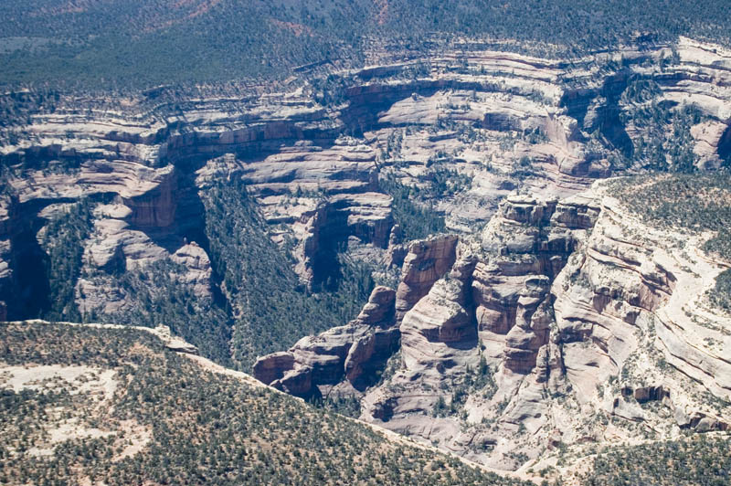
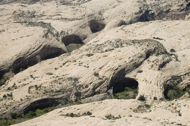
On the way home the last day I was snapping pictures like crazy. Here are some of my favorites:
The date was now 29 April 2007; the course was officially over and it was time for me to continue my trip. I flew up to McCall to visit friends and on to Seattle to visit my house. Then a pleasant overnight stop at Schafer Meadows MT, where a herd of elk grazed the runway in the evening and a moose crossed at daybreak as we were preparing to leave our great campsite in the trees.
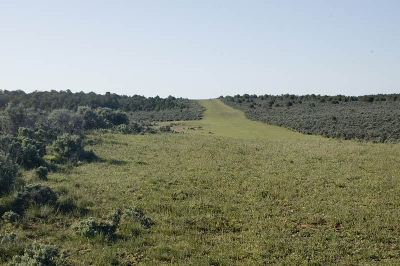
Schafer Meadows airstrip, MT. Length 3200', elevation 4855'. The camping area and one of the tiedown areas are at far right end of airstrip. The ranger cabins are on right side of the strip. There are many trails around here and beautiful scenery.
Great camping area with two outhouses, several picnic tables, fire rings, and raised fire grates. There was an abundance of deadwood lying around.
Karen's son Chris, who joined me in Seattle for the trip back to Poplar Grove IL.
When you come right down to it, life's pretty good when you have an airplane!
McCall Mountain Canyon Flying Seminars
If you want to experience the backcountry of Idaho, the seminars are held during June and July. Any earlier and there is snow on the strips and the weather is uncooperative; any later and fire season has started, with typically reduced visibility, firefighting TFRs, and vistas reminiscent of LA on a smoggy day. There is nothing magic about flying the backcountry, but it sure helps to spend some time with a backcountry instructor. The MMCFS website lists the skills needed, which include a thorough knowledge of your airplane's slow flight behavior at altitude (airstrips are typically at 4000'-7000' MSL) and the ability to land exactly where you intend to. The strips are short, and usable terrain is at a premium in the canyons. On the first day of the seminars the participants learn the characteristics of their aircraft in all configurations and attitudes near stall speed, and a stabilized approach speed is selected that is used throughout the seminar. A stabilized approach at a constant airspeed that results in minimal flare and float distance is the key to a safe landing; you don't want to give away runway by approaching 20 kts too fast! Most of the strips are one way in, one way out, with no go-around after committing to the approach; good pilot judgment becomes critical. The abort point might well be a mile or more from the airstrip, maybe even before you turn final.
Most of the Utah strips are not in as confined an area as the Idaho canyons, but they have their own personalities too....soft runways, livestock, hotter weather, winds, and they are often short and rough and not as well maintained. The Utah seminars are in the spring and fall (this year they are in late April and late September). Spring is also cactus bloom time, so should anyone need a spousal excuse for a trip, plan to visit, for example, the desert museum in Tucson. There are many other attractions, such as national parks, pueblo country in New Mexico, Navajo country in Arizona and Utah, to name just a few. Impress your friends by visiting the pinto bean capital of the world!
Utah Back Country Pilot's Association
These pilots are dedicated to preserving the rich aviation heritage of Utah. With well over 200 strips in the backcountry there is a need to preserve these strips for aircraft access, as well as to be a central source of information on current conditions, restrictions, and volunteer maintenance activities. UBCP is certainly deserving of our support. The website tells all, as well as providing a wealth of information in the Galleries section. You can buy Jim Clark's video of flying the canyon country at a reduced rate through this website; it is a well-produced pleasant change from the budget aviation videos that only a pilot could love. Karen and I bring out Jim's video for guests from all walks of life and they all love it.
Q.E.I. Publishing and Galen Hanselman
From the webpage...."Galen specializes in producing the highest quality pilot guides and charts for the unexplored regions of the American frontier. His extraordinary and beautifully created works are considered the Holy Grail of Adventure Pilots around the world. For the Nervous Nellies, his books present an inspiration to "get out of the pattern." Besides being a great read with lots of pretty pictures, the books are highly collectable".
We met Galen and his people a year ago in Utah as they were working on the Utah book (to be published in June and mailed in July of 2007). It is much more detailed than the Idaho and Montana books (which I also have), and these books are must-haves for a backcountry pilot in those states, especially the Idaho book which is in its second edition now. As an example of the new Utah book (we got prepublication samples for the seminars), each airstrip has four pages describing the runway profile in graphical form, planform of the runway, photograph, and commentary; the history of each and what to do there are even more extensively described in a separate section of the book.
Their website only describes their charter and flightseeing operations, but Lavar Wells is their chief pilot and a great flight instructor, and you can arrange for backcountry instruction by contacting Red Tail. Lavar's wife Susan will probably be the one that answers the phone.
I found this nice write-up from 2004, and a recent issue of Pilot Getaways also wrote up a visit to Dolores Point.
This is a guest ranch located on the Tavaputs Mesa that opens during the summer. They prefer guests either fly in with a commercial operator or drive up from the valley in jeeps. However, their website says they allow guests to fly in after receiving instruction locally; contact the ranch if you plan to fly in.